Home
TO PROVIDE FOR THE WISE USE, MANAGEMENT, AND DEVELOPMENT OF THE COUNTY’S NATURAL RESOURCES
HIGHLIGHTS
BCCD Board Meeting May 14, 2025, at 8 a.m.
Updated Fee Schedule Effective January 1, 2025
Green & Growing: Bucks County Community Conservation and Native Plant Expo
Kids Annual Father’s Day Fishing Derby
2024 BCCD Director Memorial Scholarship for Continuing Education
The Lake Luxembourg Story, an Interactive Story-Map and a 10 minute Podcast
OVER 60 YEARS IN PURSUIT OF ENVIRONMENTAL EXCELLENCE PROTECTING THE COUNTY’S NATURAL RESOURCES
The Bucks County Conservation District works to educate and help people and the community take care of the natural resources in Bucks County including soil, water, wildlife, trees and other plants. Using natural resources wisely helps to ensure their availability well into the future.
BCCD BOARD MEETING WEDNESDAY, MAY 14, 2025, at 8:00 am
The next BCCD Board meeting will be held on Wednesday, May 14, 2025, at 8:00 a.m. at our office and also via a virtual platform. The BCCD Board of Directors meetings are open to the public. If you would like to participate in this meeting, please contact our Board Secretary, Marilyn Laurelli to receive the link and password. The May Board meeting agenda is posted here: May 14, 2025 Agenda.
BCCD CLOSED TUESDAY, MAY 20, 2025
BCCD will be closed on Tuesday, May 20 for Primary Election Day. BCCD will reopen at 8:00 a.m. on Wednesday, May 21. Please do not leave packages when we are closed. Thank you!
LAKE LUXEMBOURG UPDATES – APRIL 2025
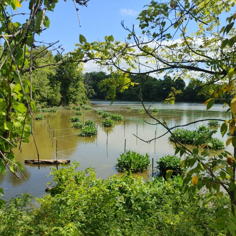
The Bucks County Conservation District, in collaboration with Bucks County Planning Commission and Princeton Hydro, has launched an interactive ArcGIS StoryMap showcasing the Lake Luxembourg Conservation Pool Restoration Project. This engaging web application weaves together interactive storytelling, multimedia, charts, diagrams, and dynamic web maps to provide an in-depth look at the decade-long journey to restore Lake Luxembourg’s Conservation Pool.
Designed as a publicly accessible resource, the StoryMap allows users to explore project details in an intuitive, interactive format—zooming and panning through specific project areas, viewing site attributes, and navigating restoration initiatives without the need for specialized GIS software or training. Its goal is to connect the community with its watershed, showcase the significance of restoration efforts, and inspire environmental stewardship.
Short on time but want to hear about the project, listen to an AI -Generated Podcast that gives you the highlights.